

When carrying out any excavation calling Dial Before You Dig (DBYD) is only the first step. To avoid costly and dangerous damage you must still get a more definite picture of exactly where buried services lie. A range of tools and techniques are available to help locate underground utilities.
A DBYD map is a vital starting point, but once you are on-site the actual services rarely follow exact the path indicated in installation plans. Common utility services such as electricity, gas, water and communications cable are usually buried at a depth of 200 – 600mm beneath the surface. Striking even domestic power or gas supplies is a serious health and safety issue that can result in serious injury or even death. Damage to other services can cause disruption leading to compensation claims that run into many thousands of dollars.
There are three main methods of locating and avoiding buried services:
Ground penetrating radar (GPR)
This non-destructive method sends short impulses of high frequency radio waves directed into the ground to acquire information about the subsurface. The energy radiated into the ground is reflected back to the antenna, distinguishing features that have different electrical properties to that of the surrounding material. The greater the contrast, the stronger the reflection. It allows for detailed mapping of both the path and the depth of the utilities.
It can be used for subsurface mapping or to verify the information on an existing map.
This is used for locating large non-metallic services such as plastic gas or water mains, concrete pipes or services located under concrete slabs. It is not so effective for locating small domestic cables or pipes.
Advantages
GPR’s advantage is greatest when pipes are non-metallic and not readily located with traditional locating devices.
It is simple to deploy on-site and gives an immediate response visual with good depth estimate. It is self-contained and does not require hooking up to the utility and detects a variety of buried obstructions. It can sense both metallic and non-metallic structures
Things to watch out for
The frequency of the radar signal used for a survey is a trade-off. Low frequencies (250 MHz – 50 MHz) give better penetration but low resolution so that pipes and utilities may not be seen. Pipes and utilities may be seen using higher frequencies (500 MHz) but the depth of penetration may be limited to only a few feet especially in the wet, clayey soils. The GPR frequency is dependent upon the antenna. Once an antenna is selected, nothing the operator can do can increase the depth of penetration. Radar data is ambiguous. Many buried objects produce echoes that may be similar to the echo expected from the target object. Boulders and debris produce reflections that are similar to pipes and tanks. Subtle changes in the electrical properties along a traverse caused by changes in soil type, mineralogy, grain size, and moisture content all produce “noise” that can make interpretation difficult. Interpreting radargrams is an art as much as a science.
Limitations
Performance can be affected in high-conductivity soils such as clay or salt-contaminated ground.
Traditionally, interpretation of GPR results was complex and required extensive training and expertise, however new products are now appearing on the market which are both lower cost and simpler to interpret.
Radio detection/pipe & cable locators
This uses a combination of transmitter and detector to locate services directly. Various methods are used to inject a radio signal into the service directly (metallic pipes and cables) or indirectly by pushing a copper cored duct rod into pipes or ducts and detecting a signal injected into the rod.
Advantages
Pipe and cable locators are normally simple to use and highly portable.
Radio detection is the most appropriate and cost effective method for most domestic and landscaping applications
Limitations
This method is only effective in detecting metallic objects. Plastic gas services and mains as well as some fibre optic cables are buried with a trace wire so that pipe and cable locators can be used to locate them.
They can also be subject to interference from other objects.
Vacuum excavation
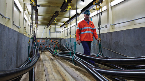
In many cases it is necessary to expose the actual services to determine the precise location. This must be done in a non-destructive way.
This method uses a truck or trailer mounted high volume vacuum pipe, often in conjunction with high pressure water jets to expose buried services. This method is usually used to prove service locations where multiple services are co-located in a dig site and can also be referred to as hydro-excavation, non-destructive digging (NDD), potholing or daylighting
Advantages
Vacuum excavation is often used in urban areas and around sensitive services such as high-voltage power or high pressure gas and optic fibres.
The technique can also be used for broader excavation projects in high density areas.
Things to watch out for
A small risk of damage to the services still exists with vacuum excavation, and using the correct pressure is vital. The technique also creates a need for slurry disposal.
Limitations
Exposing a service still requires it to be correctly identified and it doesn’t necessarily limit the possibility of other unknown services nearby.
Other considerations
There are many different types of equipment available to achieve similar outcomes but your service locator should provide the following:
1. The locator must be fully insured and experienced in the type of service location required.
2. Telstra Accredited Plant Locator (APL) accreditation is a legal requirement to locate Telstra assets and is a prerequisite for valid insurance cover.
3. Locating contractors should be members of NULCA the Locators association to ensure that they are kept up to date with legal and technical developments
4. Your locator should ensure that you are made aware of the limitations of the equipment and the expected degree of accuracy of the locate.
5. Local conditions such as multiple services located together or heavy reinforcing in concrete slabs can interfere with locator signals and reduce accuracy.
6. Your locator should always discuss what they have found and marked with you or your staff on site.
7. Your locator should give you a cost estimate and a maximum that will be charged before starting the job.
This article was created with the help and advice of Detection Solutions, Lord Civil and Underground Locating Victoria. For more information contact Damien de Castella on 0417 327 570 or [email protected]