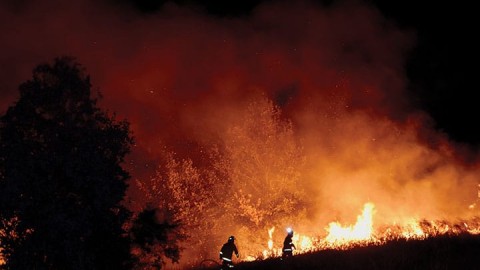


Bushfire risk is one of the most the significant safety issues for electricity networks. Historically, this risk has been managed through annual vegetation maintenance programs applied across the whole network. A significant trial based on spatial conflation and geo-statistical analysis has seen Endeavour Energy explore better ways to analyse light detection and ranging data (known as LiDAR) of vegetation near its network. This will help the Western Sydney distributor maintain the lowest network charges in NSW and keep services to customers safe and reliable.
 LiDAR compiles a very accurate three-dimensional model of the network and surrounding vegetation, which can then be analysed in much greater detail on a geographic information system.
Until now, the data captured by LiDAR has been used to determine if vegetation is encroaching within minimum safety clearances of power lines for annual bushfire compliance purposes. Now, Endeavour Energy is using greater analysis of this data to optimise its maintenance program through more in-depth information about the vegetation growing near its network.
To do this, Endeavour Energy collaborated with NM Group and Durham University in the UK to develop and trial a new suite of tools using cloud-based processing of very large, multi-year datasets to create a highly detailed picture of the vegetation near its network.
These new tools provide key information such as which spans are vegetated, the proximity of trees within each span, how many years before a span becomes non-compliant and which trees are more likely to fall and impact the line, therefore requiring proactive management.
The objectives of Endeavour Energy’s trial were to establish an inventory of trees and predict vegetation growth to help optimise maintenance cycles to better measure and manage the risk of trees growing near its network.
The project involved:
Collating and preparing three years of LiDAR data, contractor cutting records, hazard tree history and calculation/risk criteria
Mapping more than 3500 fallen trees in each of its management areas and building detailed statistical models to predict the risk of trees falling onto its network
An extensive field campaign – 43 sites and 400 trees measured and inspected – to derive biological factors from LiDAR
Generating spatial layers, predictive models, growth comparisons and output reports which describe inventory, growth and fall risk.
How is the data used?
Endeavour Energy’s Vegetation Control Manager, George Popovski, said, “Having well organised and high-quality data is a key input to this type of project which uses powerful data analytics, cloud processing and machine learning techniques to optimise our vegetation maintenance program.”
“There are three main areas where the LiDAR project is helping us to better manage risk and improve the efficiency and effectiveness of our vegetation management.
Inventory: knowing which spans have trees, and how many and how close they are to the network, allows the development of more agile maintenance cycles to better manage risk and vegetation maintenance costs
Growth: by understanding how vegetation is changing on each span to better prioritise and schedule cycles of vegetation maintenance, rather than a one-size-fits-all approach. This provides us with data that validates if some spans may not need inspection or trimming every year
Identification of potentially hazardous trees: this technology can help identify which trees have the potential to fall onto the network. This helps us put the greatest effort into the highest risk areas and target inspections by qualified staff to make more detailed assessments.”
Taking the proactive approach
The outcomes of the project enabled Endeavour Energy to create priority lists to see which areas requires immediate attention and predict how long before that part of the network became high-risk. For example, the data can single out spans that have vegetation within the one metre growth allowance which are projected to be high-risk within two years.
The data also makes it easier to determine if tree removal is required as opposed to ongoing pruning. This happens by identifying spans where there are more than five trees within the one metre safety clearance, suggesting a lower cost removal rather than pruning every year.
The LiDAR data can also locate hazardous trees by identifying spans where trees have a greater likelihood to fall onto a powerline or exclude spans where there is no vegetation near the network so no immediate maintenance is needed.
Using different filters, the data can show the number of years until a specific bay of powerlines becomes high risk, the exposure of individual trees to wind gusts and the size of the overstrike should it fall towards the network. GIS colour coding allows rapid visualisation to provide a quick overview of the situation of any span such as its compliance status or the worst-case scenario of trees falling onto a section of the network.
Managing the challenges
There were many variables to consider and challenges tackled during the trial. Most significantly the sheer volume of data collected posed logistical and processing challenges due to the ambitious project timelines and deliverables.
“We worked with NM Group to design reports that would dovetail with the software and systems we already had in place without degrading the value in the underlying data,” Mr Popovski said.
“We had to ensure that our subject matter experts could adequately scope the report formats and conduct field verification.”
The future of LiDAr
Moving forward, Endeavour Energy believes there is potential for LiDAR data to become an even more valuable maintenance tool for its entire network.
“There is an immediate opportunity to roll out the trial across the entire network, not simply in bushfire prone areas,” Mr Popovski said.
“We are also looking at improving the growth models with current and forecast climate variations to build a picture over five years or more.”
In the future, more data fields can be added into the program to further increase the efficiency and accuracy of the program. It could look at the inclusion of surrounding forests to aid in storm preparation and fall prediction in under multiple storm scenarios.
“Now the detailed field campaign has been done, the fundamentals, the predictive models won’t radically change over time. This means that the project is sustainable in the long term,” Mr Popovski said.
“We will make further improvements to the analysis methods and predictive models as new information and datasets become available.
“The end game is to have the best possible technology to predict when vegetation is likely to impact our network. This will help us trigger the relevant maintenance to keep the community safe and the lights on at the least possible cost to our customers.”