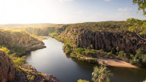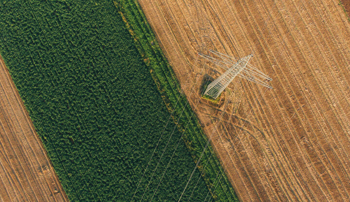

From roads and railways to power lines and pipelines, encroaching vegetation can cause downtime, damage and catastrophes. Utility vegetation management remains a huge line item in most annual budgets, involving manual inspection of thousands of infrastructure miles. But it’s mainly reactive maintenance, leaving very little focus on prevention. Satellite technology provides a great opportunity to augment existing methods, offering more scalability, reliability, and flexibility.
Satellites can capture long corridor lengths frequently and in a single pass. This approach drives efficiency and savings, and removes the constraints of LiDAR and UAV photogrammetry. You can identify risk areas for further investigation with helicopter optical imagery, LiDAR, and UAV photogrammetry to avoid costly image capture of the entire infrastructure.
Or task a satellite for a specific time and specify cloud coverage, which improves reliability and predictability, and reduces risks from bad weather. Furthermore, using satellites for the most inaccessible points of infrastructure maximises compliance and minimises the risk of danger to employees.
Satellites offer different types of useful data; optical satellites take imagery in the visible or near-visible portion of the electromagnetic spectrum using existing radiation. When optical satellites take imagery of the same point from two or three different locations, those images are combined to construct digital surface models, which are important for utility vegetation management.
Synthetic Aperture Radar (SAR) sensors capture imagery by transmitting microwaves at a target and catching the backscattered signals at any time, day or night. SAR’s microwaves can penetrate clouds, haze, dust, or canopies and dense vegetation, to give information on different layers of vegetation.
Elevation data can be used to track differences in elevation (height or volume) and ensure that hazards such as vegetation encroachment are monitored, predicted, and mitigated, minimising damage.
Intelligent vegetation management system
A great example of rethinking vegetation management with satellites comes from AI-first SaaS company, AiDash. Geospatial developer platform and marketplace, UP42, helped AiDash transform the process for its customer, a Fortune 500 utility company that wanted to improve vegetation management along lines spanning over 80,000km.
AiDash’s client relied on a traditional approach, with trimming cycles spanning four to five years and including manual data collection. This time-consuming process gave it minimal predictive capabilities for future outages, damages, and costs. To solve the problem, AiDash developed a proprietary AI model called the Intelligent Vegetation Management System (IVMS), with satellite imagery from UP42.
Through the UP42 platform, AiDash accessed both archive and very high resolution (50cm) Airbus Pléiades imagery of utility lines, providing detailed coverage for the customer’s remote asset monitoring needs. AiDash was able to predict species’ growth rates in each feeder across different utility towers and different height levels.
The company prepared a three to five-year trim plan for the entire network with an accuracy of over 85 per cent, improving system reliability by 15 per cent and reducing its annual budget for vegetation management by 20 per cent. There are countless more potential applications for vegetation management – from combining weather data with multispectral data to forecast strong winds affecting trees, to analyzing the state of the surrounding forests for risk of fires.
With the recent emergence of dedicated geospatial platforms offering easy access to complex data, satellite imagery has proven to be the complementary tool of choice by many utility operators and solution developers, enabling more targeted and efficient solutions.
This sponsored editorial is brought to you by UP42. For more information, please visit www.up42.com.